Metservice has issued a Severe Weather Watch for the Coromandel over the coming days and has warned it could bring further slips and surface flooding to the district.
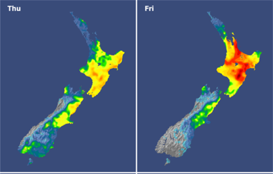
Metservice has issued a Severe Thunderstorm Watch for the Coromandel Peninsula and the Hauraki Plains until 10pm tonight with thunderstorms developing from this afternoon.
“Some of these thunderstorms may become severe, producing downpours with intensities of 25 to 40mm per hour,” Metservice said.
“Rainfall of this intensity can cause surface and/or flash flooding especially about low-lying areas such as streams, rivers or narrow valleys, and may also lead to slips.
“Driving conditions will also be hazardous with surface flooding and poor visibility in heavy rain.”
Metservice has also issued a Heavy Rain Watch for the Coromandel Peninsula from 2am tomorrow morning until 1am on Saturday with periods of heavy rain and possible thunderstorms.
Thames-Coromandel District Council (TCDC) said while the forecasted weather was nowhere near as intense as the past few weeks, any rain on the district’s already saturated land was likely to create more slips and surface flooding.
“We will be receiving regular updates from MetService and the Waikato Regional Council over the next 24 hours, and we will post these as soon as we can,” council said.
Council road updates will be published on the TCDC website and Facebook page.
Visit Waka Kotahi for State Highway information and Metservice for weather updates.