In the space of a fortnight, Waihou Valley’s flood protection scheme has worked ‘magically’ to protect its towns from further damage caused by two severe weather events. KELLEY TANTAU dives into the scheme’s history and hears how Thames Valley communities would ‘not be able to function’ without it.
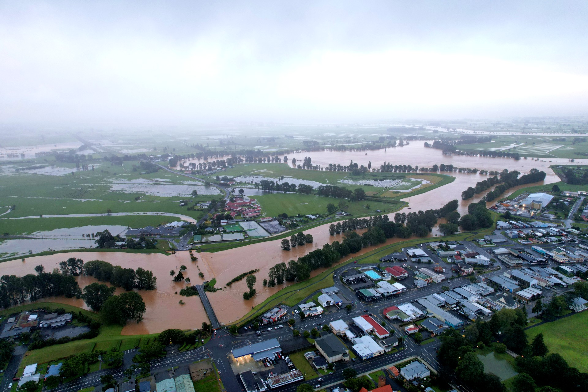
It was as clear from the ground as it was from the sky: the Waihou Valley’s flood protection scheme had done its job during not only one severe weather event, but two.
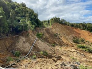
The Hauraki and Thames-Coromandel districts were hit with heavy rain, slips, surface flooding, and road closures over the storms of Auckland Anniversary weekend and Cyclone Gabrielle.
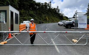
The latter arrived in the rohe in the early morning hours of Valentine’s Day, and warranted the floodgates at Criterion Bridge, Paeroa, to be closed for the first time since they were installed in 2018.
“We were getting modelling right throughout the day as to what the potential [Ohinemuri River] rises could be… The state highway to Waihi was closed at 10.30pm due to slips rather than flooding, and at 1am, the gates shut – and at the right time,” Hauraki Mayor Toby Adams said.
“The level of the river had got to the height of the main street of town, so the stopbanks performed magically. Absolutely magically.”

The Waihou Valley flood control scheme was carried out between 1972 and 1997.
The scheme was designed to put an end to flooding, such as what was experienced in 1981, when Paeroa and Thames suffered considerable flooding and more than 2000 people were evacuated.
According to NIWA, half the town of Waikino was completely destroyed when the Ohinemuri River broke its banks, and a Civil Defence emergency was declared in the Paeroa Borough and Ohinemuri County, as well as the Thames-Coromandel area.
A long-time resident of Station Rd, who didn’t want to be named, said he lived in Paeroa during the town’s floods of 1981, and recalled going “down the main street in a row boat”.
Following Cyclone Gabrielle, his garage was flooded, but his home was “alright” – and he said Waikato Regional and Hauraki District councils had “done a really good job” closing the floodgates and mitigating what could have been widespread damage within the town.
“We’re extremely lucky in the fact that we’ve got a really awesome drainage and flood protection system throughout the Hauraki,” Mayor Adams said. “If we didn’t have the stopbanks where they currently sit now, or the stopbanks at all, the town would’ve been underwater.”
The Waihou Valley scheme was the biggest flood protection scheme undertaken in New Zealand and cost more than $178 million.
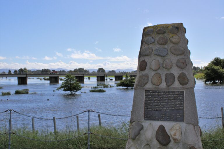
Collectively, the Waihou Valley and neighbouring Piako River schemes include 357km of stopbanks and floodwalls, 139 floodgates, and 52 pump stations. They help protect Te Aroha, Paeroa, Thames, Ngātea, Turua and Kopu.
The Waihou scheme is one of the country’s best and is often labelled “the Rolls Royce” standard, Waikato Regional Council’s flood protection and land drainage manager Adam Munro said.
“Without the flood schemes in place, communities would simply not be able to function as they do on the Hauraki Plains. Much of the plains are at or below mean sea level, meaning that without the flood schemes in place – especially the stopbanks – some areas would flood every high tide, twice a day.”
Mr Munro said Cyclone Gabrielle and Cyclone Hale – which arrived in January – had “certainly tested” council’s infrastructure.
He said river level recorders in the Ohinemuri provided timely alerts on when flooding may occur. They recorded levels every five minutes, and this data was electronically sent to the regional council in real time.
These notifications, along with modelling using weather forecasts, meant the council knew when to close the gates across SH26 before the river levels got too high.
“We got to close the Criterion Bridge floodgates for the first time since they were installed in 2018, so that was very rewarding to see how well that piece of engineering stood up to the job, holding back the Ohinemuri River from flooding the state highway, the school, properties and farmland,” he said.
“Infrastructure such as stopbanks and spillways mostly go unnoticed until you have a really big event such as Gabrielle and Hale, and it’s then that people see them in action and really appreciate how much water they hold back… that’s when they’re really valued.”
Meanwhile, construction including earthworks on the Firth of Thames foreshore east and west stopbanks project continues.
This is a three-year project to upgrade the height of the stopbanks to design standard.
Regional council said the work was “critical” for the flood protection of the Hauraki Plains, from the Firth of Thames to Te Aroha on the Waihou River, to almost Morrinsville on the Piako River.