You are currently viewing SH25A: a jagged scar across the Coromandel
Media trek down the slope to see the State Highway 25A slip in person. Photo: SUPPLIED/WAKA KOTAHI

SH25A: a jagged scar across the Coromandel

KŌPŪ-HIKUAI UPDATE

Monday morning on March 27, and representatives of every media outlet from across the North Island are gathered in a huddle for a safety briefing before heading into the hills to inspect the slip on the Kōpū-Hikuai Rd.

The highway, once a main corridor for traffic to and from the Coromandel, has been closed since January 27, when cracks in the road’s surface began to widen and slip.

It’s a strain for local communities; many businesses are struggling, with some losing up to 90 per cent of their revenue. The lifeblood of the peninsula, tourists, are bypassing many small towns altogether. We are among the few who have travelled this road since.

It’s a sunny day, and as we line up into a convoy for the journey, it’s hard to believe that two destructive cyclones have recently ripped through the area.

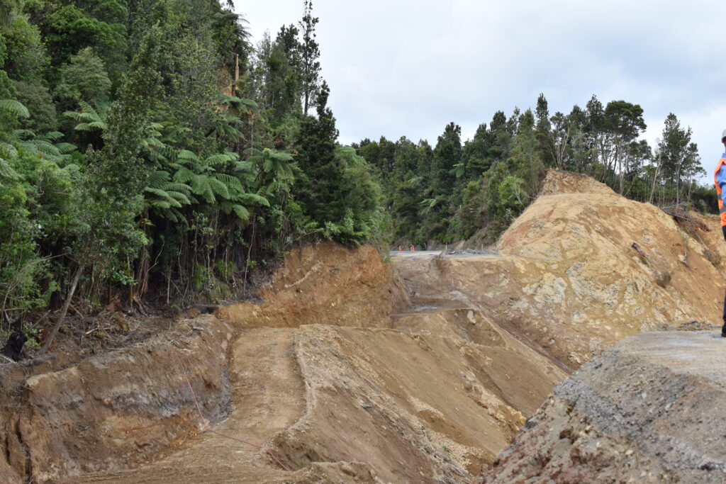
The road up to the site however, is still scarred from the wind and rain. Around every corner, sheer rock faces spill their guts towards the road, cleared now from the tarmac but still piled menacingly close to my tires as I drive cautiously towards the chasm.

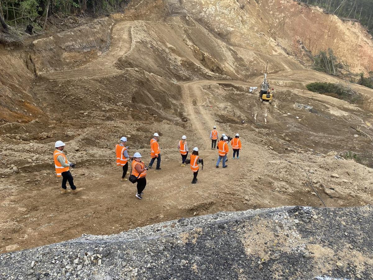
And chasm it is. We pile out of the vehicles and make our way to the edge, decked out in protective vests, hard hats and safety glasses, eager to see what photos and drone footage have tried to convey to us for the past few weeks.

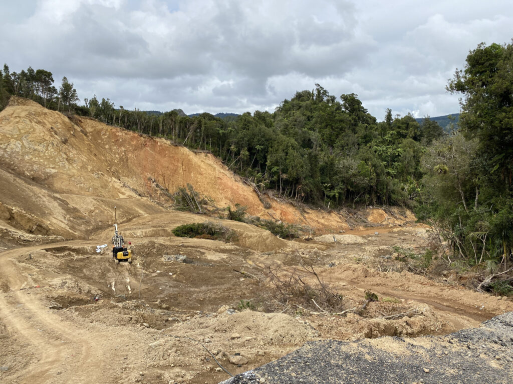
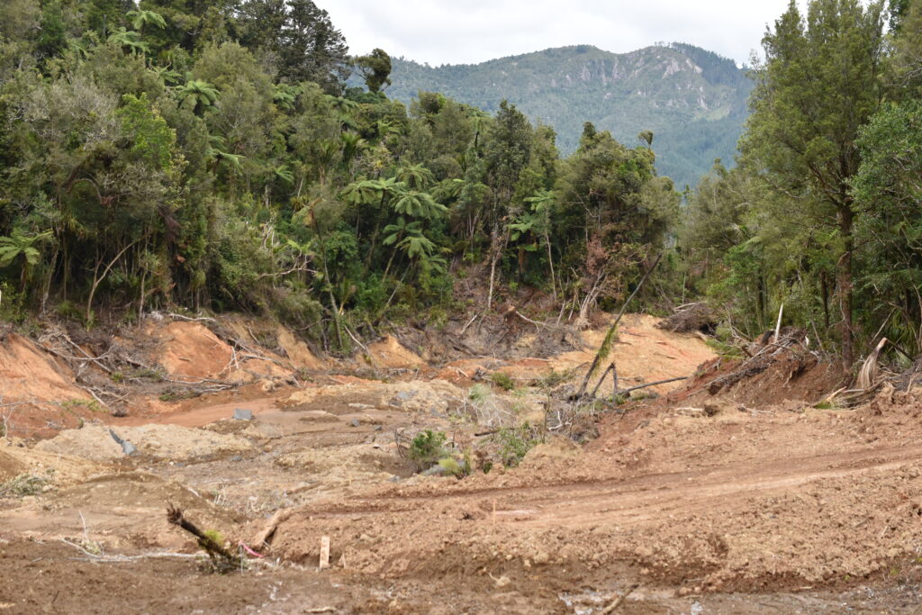
We’re met with … nothing, just the road dropping away beneath our feet. Where once there was lush, verdant bush and a winding black ribbon of road twisting its way through, instead we see a sea of orange and brown; the muddy, clay remnants of the cliff to the left of where the road once lay.

We’re told the slip debris is variable, formed largely from clay and sand in some places, with rock found easily in some places and not in others.

“Over a rugby field in length,” we’re told by Waka Kotahi NZ Transport Agency in the days and weeks following the storms.

But gazing upon it in person, the 130 metres it encompasses feels so much more vast, immense, monstrous.

Several metres below, a lone drilling rig is set in the base of the slip. It’s drilling bore holes, which will reveal the layers of soil in the ground below.

The samples will be put together in a model of the site and analysed as part of the decision-making process.

Looking from the Kōpū side of the road to the other edge, 130 metres away. Photo: ALICE PARMINTER

Waka Kotahi has outlined the three possible fix options it is investigating; a bridge, a bypass, or a retaining wall in the original road’s place.

In a few months, this site will be buzzing with activity as contractors work to fulfil Waka Kotahi’s chosen fix. But for now, the rig and a couple of geotechnical engineers are the only other people on site. The rig itself, nearly four times taller than a person, appears minuscule within the footprint of the damaged land.

Our media group is briefed just metres from the jagged edge of the chasm.

BECA lead geotechnical engineer Nathan McKenzie explains the technicalities of the testing, while Waka Kotahi regional manager of infrastructure delivery Jo Wilton talks us through the likely solutions and timeframe of the remediation project.

The drilling rig is almost four times as tall as a person. Within the slip site, it looks almost toy-like against the backdrop of orange soil. Photo: ALICE PARMINTER

Jo’s confident the road can be reopened in 9-12 months from now, although she cautions that construction work heading into winter could be delayed by bad weather.

Then we’re escorted down into the slip itself, walking several metres along a dirt path.

“Stay on the marked track,” we’re warned.

While there is no longer any significant movement in the slip, there is a lot of water still in the ground, and some of the earth is like quicksand – one wrong step and we could sink up to our knees or further.

It’s clear that whatever solution is chosen to repair the road, this is no quick fix. The gap is not just across, but 30 metres down as well – there’s nothing left to support a road. Even to a layman’s eye, it’s going to take much more than just some replacement gravel and bitumen.

A steep climb out of the slip, and I’m in my car, headed back towards the office.

In the rearview mirror, the muddy scar gives way to trees. It’s like it never existed.

By ALICE PARMINTER, Public Interest Journalism funded by NZ On Air


Debris has flown into the valley. Photo: ALICE PARMINTER

LATEST UPDATE: Geotechnical investigations at the site of the slip on State Highway 25A were completed on April 4, Waka Kotahi confirmed. Fourteen boreholes were drilled and five test pits dug. Material found above and in the slip was variable, with rock discovered quickly in some areas, and other areas consisting of wet and soft soil. Waka Kotahi is planning to make a decision on a permanent fix in May. Work will continue at the site in the meantime, with drainage material being installed to protect the area.