
Recovery efforts from the January storm event that swept across the Coromandel Peninsula are now well underway.
Thames-Coromandel District Council (TCDC) and Hauraki District Council (HDC) last week moved out of emergency mode, and began making assessments on the stability of roads, water services, parks, reserves, and other infrastructure across the region.
ROADS
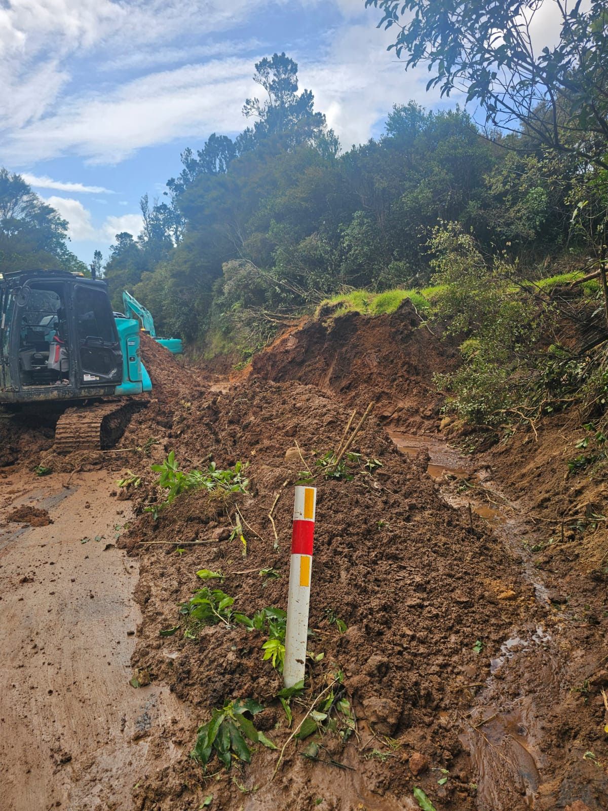
Almost all the roads in the region have now reopened, although not to full capacity as work continues across the roading network to clear slips and repair damage.
In Hauraki, a section of SH2 through Karangahake Gorge has been reduced to one lane and will remain under stop/go traffic management for some time.
The Waitāwheta Bridge will be closed for detailed structural assessment work on February 3-4 between 8am and 4pm. The closure is not storm-related; however, it had to be postponed from its original closure date in January. Traffic will need to detour through Waihī during this time.
On the peninsula, SH25 between Hikuai and Kūaotunu West is open, but delays will be likely with stop/go traffic management operating along parts of the highway for the foreseeable future, the NZ Transport Agency said.
A section of SH25 south of Kūaotunu will close in both directions from 9am on February 9, in order to repair cracks which have emerged above an existing slip. The road is expected to reopen late on February 11, weather permitting. A detour will be in place via SH 25 and SH25A.
The NZTA said the ongoing cleanup is expected to take some months.
“Currently, there are around 20 locations around the Coromandel where SH25 is down to one lane due to slips above or under the road. Some of these will be simple to clear, however others will need further work to stabilise the slope before the road can reopen to two lane traffic.”
Further road closures are also scheduled due to routine road maintenance work.
A section of SH25 in Whangamatā will be closed between February 10-13 for guardrail installation and surfacing work on the Moana Anu Anu Bridge, with a detour in place via Port Rd.
Meanwhile, part of SH25 through Waitakaruru will be detoured for two weeks from February 9-20 while a section of the highway is rebuilt at Mangatarata and resurfacing is carried out on the Waitakaruru River Bridge. The detour, via SH2 and Pipiroa Rd, will be in place from 8am to 5pm, Monday to Friday. The road will reopen each evening and over the weekend of February 14-15, with speed restrictions in place. Access for property owners and emergency services will be maintained at all times.
FINANCIAL RELIEF
Both councils have now opened their Mayoral Disaster Relief Funds to applications. The funds are available for residents, ratepayers or small business owners who have suffered financial hardship due to damages from the weather event, and will provide one-off assistance for extraordinary circumstances where a real need can be shown. These can include costs like clearing debris from uninsured properties; essential daily needs such as food, accommodation, and utilities; and other costs not covered by insurance, WINZ or other support.
The closing date for applications in TCDC is March 6, while HDC closes on February 27.
TCDC also announced a rates rebate for property owners whose homes were assessed as unsafe and received red placards following the storm.
TRAILS AND RESERVES
Several Department of Conservation (DOC) tracks are still closed following the storm. These include Crosbie’s Hut via the Karaka Track; campsites in Port Jackson, Stony Bay, Fantail Bay, Fletcher Bay, and Waikawau Bay; and several tracks across the Coromandel Peninsula and in Karangahake Gorge.
The walking tracks to Mautohe Cathedral Cove have reopened after inspection by geotechnical specialists, although DOC warned that people should still be alert for rockfall, landslips and debris both on the track and on the beach itself.
DOC also warned on its website that although many of its tracks are not formally closed, it will need time to assess the network and plan for repairs, and visitors should remain vigilant to the possibility of landslides, washouts, or downed trees.
The Hauraki Rail Trail has also been impacted by storm damage. Section C between Karangahake and Waihī is closed, including the rail tunnel, and the trail management have advised the area is currently extremely dangerous. A small section of the track between Waikino Cafe and Owharoa Falls is open to walkers only.
Meanwhile, Gilmour Lake Reserve in Waihī has reopened, but sections of the boardwalk are still closed with work still ongoing in the area.